Houston’s Problem: Hurricane Harvey 70 Years in the Making
What makes Houston unique is that no other American city has grown so big in such a bad location.
As the world watches the fourth-most populous U.S. city drowning in a death-dealing deluge, Tropical Storm Harvey appears to have more yet in store. Houston’s humid climate contrasts with arid West Texas in a big way, and — although that fact is painfully clear in recent days — substantial downpours have always come with the zone-free territory.
In the early 1800s, the area was nothing more than an empty marsh. The southwest corner of the “city” was a green-scum lake that lay under one to two feet of water. When travelers stopped to visit Sam Houston, who was living in the area in 1837, they approached his cabin by wading in water above their ankles.
Yet from 1850 on, the population nearly doubled every ten years.
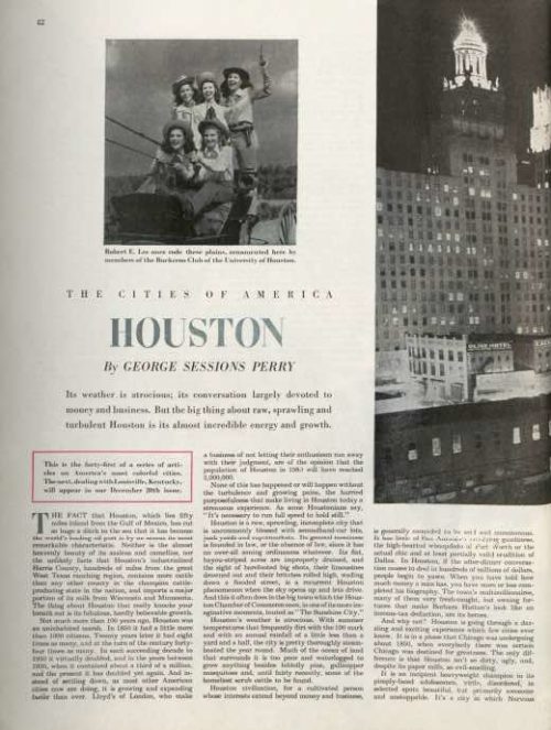
The economic giant of a metropolis made for an installment of the Post’s series “The Cities of America” in 1947. In the profile, World War II correspondent George Sessions Perry gives an abiding account of Houston’s frequent torrents: “Its flat, bayou-striped acres are improperly drained, and the sight of barefooted big shots, their limousines drowned out and their britches rolled high, wading down a flooded street, is a recurrent Houston phenomenon when the sky opens up and lets drive.” Perry is dubious of the Houston Chamber of Commerce’s claim to the title of “The Sunshine City” when he opines, “Houston’s weather is atrocious.”
Every year, the city receives almost 50 inches of rain.
The author noted another of the city’s drawbacks. A lack of zoning regulations encouraged the business and residential buildings to sprawl across the country. Today, Houston is a 600-square-mile city — bigger than Chicago, Boston, Manhattan, Washington D.C., and San Francisco combined.
Houston was only able to rise above the swamp and accumulated rainfall with the help of drainage channels. There are now 2,500 miles of channels running through the city. The risk of flooding is compounded by the possibility that water in the Buffalo Bayou, a 50-mile canal connecting Houston to the Gulf of Mexico, can overflow and quickly spread across the flat surrounding countryside. Two reservoirs have been built to contain overflow, but continuing growth of suburbs keeps adding to the water load they must handle.
The city knew a better system would be needed. But the proposed improvement would involve tearing down buildings to widen the waterways at a cost of $26 billion. Meanwhile, the city continues to expand and Houston’s annual rainfall appears to be increasing
In the 70 years since Perry’s report, Houston has had its share of 500- and 100-year floods. Most recently, floods in 2016, 2015, 2006, Hurricane Ike in 2008, Tropical Storm Allison in 2001, and the Great Flood of 1994 have impacted Houston and surrounding areas. According to Texas Climate News, Houston has seen a 167 percent increase in its heaviest downpours since the 1950s, and that number is not accounting for Harvey.
Last December, the Houston Chronicle predicted that the city would flood again, “like it always does.”
A statistic like 50 inches of rainfall in a week does little to illustrate the potential harm of Hurricane Harvey. FEMA director William Long called the storm “probably the worst disaster the state’s seen.” As the nation continues to observe, donate, and assist, Houston will set out on a long road of recovery in the months to come. The city has a history of going big and leading the country in industry and resilience. As Perry noted in 1947, “[Mayor Holcolmbe says,] ‘Other cities may have better weather, bigger orchestras, but what we’ve got more of than any other city is that old bedrock thing: opportunity.’”

Featured image: Port Arthur, TX on August 31, 2017 (South Carolina National Guard)