Take an Epic Road Trip on the Lewis and Clark Trail
More than 200 years ago, President Thomas Jefferson commissioned the Corps of Discovery, led by Meriwether Lewis and William Clark, to explore the Louisiana Purchase and beyond. Journeying on the longest river in the present-day United States, Lewis and Clark’s team made their way across the continent to map the terrain, document wildlife, and establish relationships with native tribes. After a year and a half — and more than 4,000 miles — the Corps reached the Pacific Ocean.
Though the rivers and terrain traversed by the Corps of Discovery have changed over the years — for both natural and manmade reasons — you can still take a path comparable to theirs across the country. This year, the Lewis and Clark National Historic Trail was extended to Pittsburgh to recognize the extensive preparations for the expedition that technically began near St. Louis. Traveling the 4,900 miles of the trail by car should take around a month, depending on how many of the hundreds of historical and natural stopovers you plan to include in your trip. The opportunity to encounter the complicated past of the country and its peoples firsthand is one that you’ll never forget.
St. Charles, Missouri
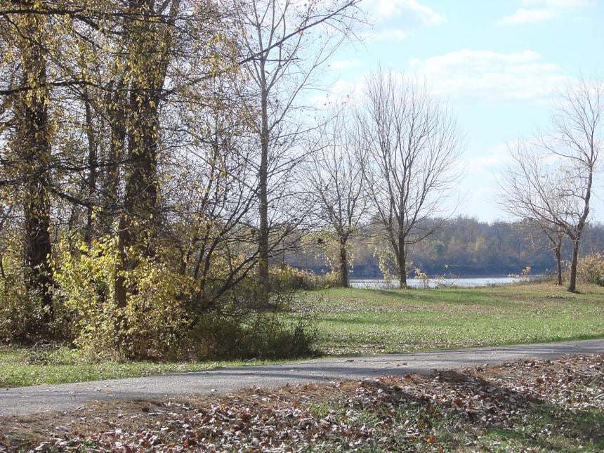
The Corps of Discovery reportedly bought all of the tobacco in St. Charles before venturing into the wilderness of the Louisiana Territory up the Missouri River. The Lewis and Clark Boathouse and Nature Center houses replicas of the keelboats that carried the team on their journey as well as interactive exhibits and a nature park. Nearby Frontier Park marks the spot where the Corps camped for five days, and — beginning there — you can bike 165 miles of Lewis and Clark’s route along the Missouri on the Katy Trail. If that seems like a lengthy trip, you can hike a mile or two of the trail instead.
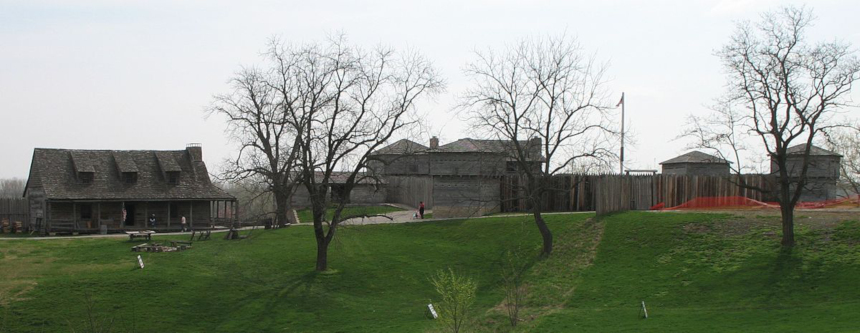
Independence, Missouri
The hometown of President Harry S. Truman was also the place where Clark was separated from the party while hunting and found his way back by firing his rifle into the air. Independence is home to the National Frontier Trails Museum, where you can see artifacts and exhibits concerning the Oregon, California, and Santa Fe Trails as well as the Lewis and Clark Trail and the Mormon Pioneer Trail. About 14 miles outside of the city is Fort Osage, an outpost built under the direction of Clark after the expedition to defend the Louisiana Territory and trade with the Osage tribe.
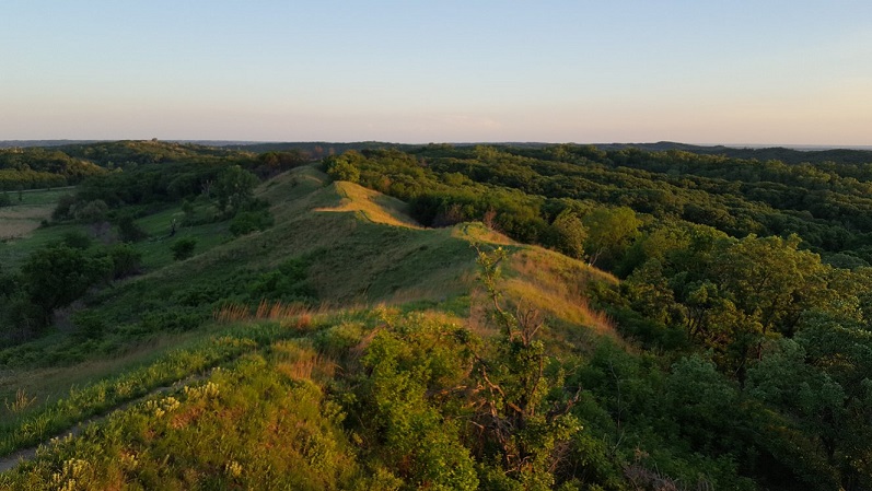
The Loess Hills, Iowa
This region on the western edge of Iowa is known for its rolling hills and bluffs created by winds at the end of the last ice age. Visit the Waubonsie State Park, near Sidney, for trails and views of the Missouri River, and stop by the Mills County Historical Museum, in Glenwood, to see prehistoric Native American artifacts and a reproduction of a first-century earth lodge.
Pierre and Mobridge, South Dakota
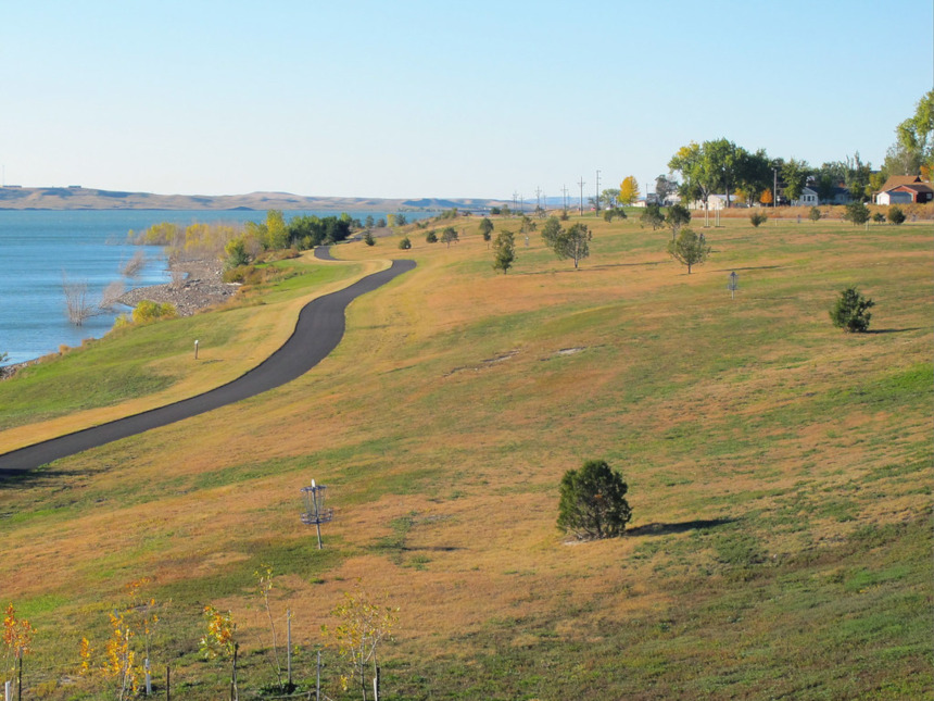
The Corps of Discovery first encountered the Teton Sioux in Pierre. The Bad River Encounter Site marks the location of the council between the party and the tribe that almost turned deadly, and the downtown South Dakota Cultural Heritage Center offers interactive exhibits about early Native Americans and the settlers that followed. Further along the trail is Mobridge, a city across the river from the Standing Rock Reservation. The site of the now-destroyed Fort Manuel is where Sacagawea died six years after her journey with the Corps. Monuments to Sacagawea and Sitting Bull were erected on the reservation just across the river from Mobridge.
The Missouri Breaks, Montana
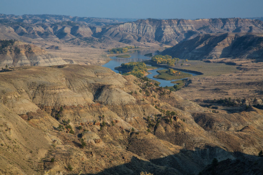
The Upper Missouri River Breaks National Monument covers 149 miles of the river that took the Corps of Discovery three weeks to traverse. The badlands, cliffs, and plains of the area are largely unchanged since Lewis and Clark’s expedition and a must-see of any Lewis and Clark road trip. Be sure to visit the site where the Corps camped at Slaughter River — so named for their discovery of more than 100 dead buffalo — and the White Cliffs of the Missouri, where the Corps would have been shocked to see such geological splendor after spending time in “a country which presents little to our view, but scenes of bareness and desolation.”
Great Falls, Montana
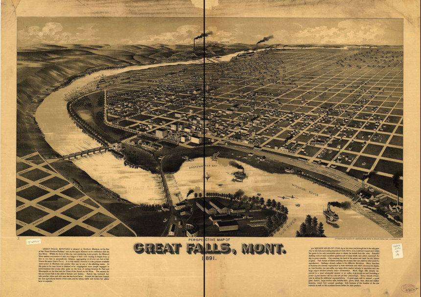
Lewis described the first of the five Great Falls as “a truly magnificent and sublimely grand object” when the Corps came upon the 400-foot waterfall in June of 1805. The group also took note of the freshwater springs now housed in Giant Springs State Park, which now feeds into a fish hatchery. Take advantage of the wildlife and breathtaking sights around this Montana hub, and visit during the Lewis and Clark Festival in June to enrich your historical adventure.
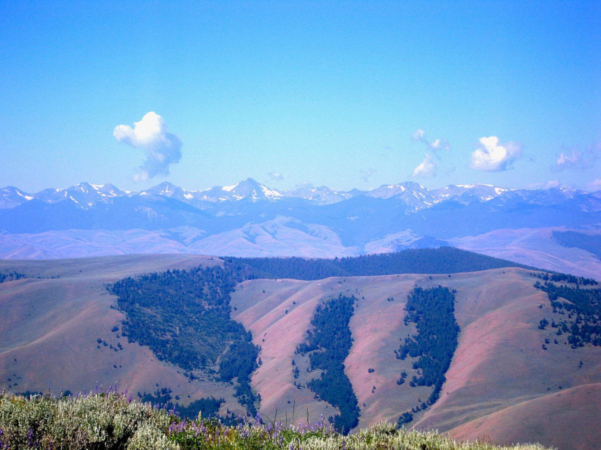
Salmon, Idaho
The Sacagawea Interpretive, Cultural, and Education Center sits just outside the town of Salmon, where Sacagawea was born. The museum offers an outdoors experience of the Shoshone tribe to supplement the Lemhi County Historical Museum’s wealth of Lemhi Shoshone artifacts and exhibits. If you take a half-day to drive the Lewis and Clark Back Country Byway and Adventure Road, the single-lane gravel road leads past several camps and sites along their trail. One of the most significant of these is Lemhi Pass, where the Corps stood and noticed “immense ranges of mountains still to the west” after thinking they were getting out of the Rockies.
The Dalles, Oregon
Clark estimated a village in the Columbia River Gorge to be drying 10,000 pounds of salmon when they passed through in 1805. The Corps traveled into the densely forested canyon from the arid desert of eastern Oregon, and — with breathtaking waterfalls, cliffs, and vistas — the area continues to be a land of plenty. The Dalles is the perfect place to learn and play, with the renowned Columbia Gorge Discovery Center giving an exhaustive history of the Gorge and places like Celilo Park offering spots for windsurfing and swimming.
Ilwaco, Washington
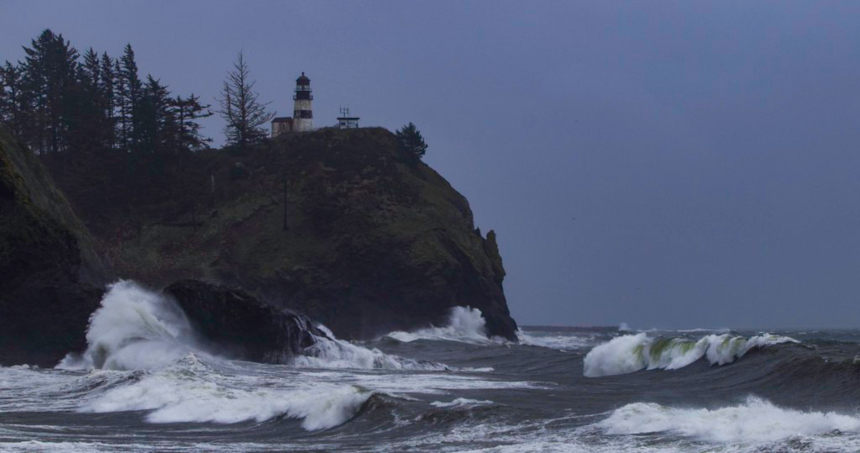
When the team reached the eastern end of Gray’s Bay, close to where the Columbia meets the Pacific, Clark wrote “Ocian in view! O! the joy” in his journal. As it turned out, they were still about 20 miles, and three weeks of storms, from sea. They reached the Pacific, eventually, in present-day Ilwaco, Washington. Cape Disappointment’s Lewis and Clark Interpretative Center offers a history lesson on the Corps’ journey against the backdrop of an 1856 lighthouse and the pounding surf of the Pacific.
Astoria, Oregon
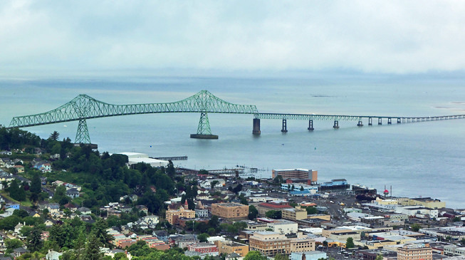
Although the Corps of Discovery first met with the ocean in present-day Washington, the party took a vote that decided they would stay for the winter across the Columbia river in what is now Astoria, Oregon. They built Fort Clatsop and stayed from December 1805 to March 1806 — during which there were only six days without rain. The Lewis and Clark National Historical Park gives guided canoe tours, reenactments, and a replica of the original fort where the Corps spent their miserable winter thousands of miles from home.
Featured image: Ericshawwhite, Wikimedia Commons, via the Creative Commons Attribution-Share Alike 4.0 International license