As revolutions go, this one began quietly, with a buy rather than a bang. Location: Hunters Hill, a Sydney suburb so small you’d be hard pressed to pinpoint it on a map of Australia — unless you had the right kind of map. Which, until relatively recently, you almost certainly did not.
It was there, in the opening days of 2004, that four guys who ran a start-up called Where2Tech sold their company to Google, which saw an opportunity. Weeks later, the pioneering technology — rebranded as Google Maps — was introduced to the public by its new American owners. Within 24 hours, Google Maps had been viewed 10 million times. The satellite-navigation revolution was officially underway.
It’s estimated that today, in the United States, some 230 million of us rely on GPS maps for turn-by-turn guidance to everywhere that has been photographed from a satellite, even if that “where” has seldom seen human visitors. The technology has transformed the way we see our planet and, more importantly, how each of us can find our way around it. No more getting hopelessly lost.
“Before Google Maps, I wandered the earth aimlessly, discovering villages and hamlets untouched by the 20th or 21st centuries. Toothless inhabitants would surround my car in wide-eyed wonder and ask if I fell from outer space,” my friend John Oliver, a New York writer, recently posted on Substack. He was exaggerating for impact. I think.
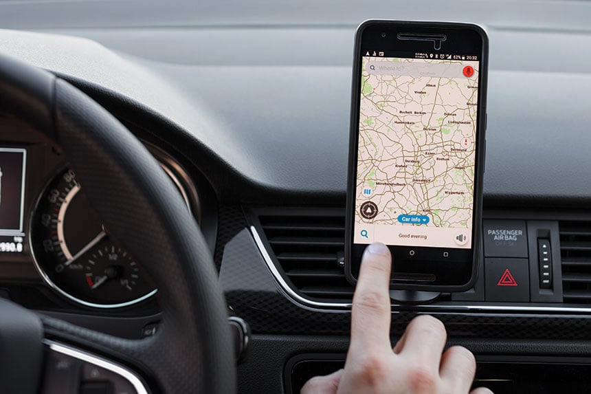
The fact of the matter is that most of us would just as soon embark on a journey without some sort of small navigation device as walk out the front door pants-less. The big guys in this space include Google Maps, of course, but also Apple Maps, Waze, and TomTom. As a navigationally challenged American, I rely on four sat-nav services, on my phone and in my car. Each has its particular strengths: details about dining specials along my route, or scenic paths, or just cool on-screen graphics.
Some folks claim they’ve become emotionally attached to the voice they selected for their GPS’s spoken directions. Not an issue for me. But a Californian I know told me he’s addicted to Chaka Khan’s soothing tones on his in-car system: “Relax your mind … turn left … we’re gonna get there. I freaking love her,” he said.
It’s no surprise that most car buyers in 2026 say they won’t even consider a model unless it has a wireless sat-nav system, such as CarPlay, onboard. GPS guidance is no longer merely a convenience; today, it’s central to a lifestyle that demands our total surrender to the ever-expanding embrace of microchips.
Even so, there remains a subset of folks who refuse to crumple up their old paper maps. Some of those were indeed things of cartographic beauty and, in their era, trusted companions. AAA’s iconic TripTik finally went digital a while ago, but those spiral-bound — and once indispensable — Thomas Guides on the West Coast still serve a coterie of hangers-on.
What’s the downside of satellite navigation? Well, for one, imagine what would happen if the system suddenly collapsed, even for just a few days. The technology is responsible for billions of dollars of economic benefit to the country due to the logistical efficiencies it’s enabled. Without it, the super-swift deliveries we’ve grown accustomed to could not happen. (Imagine if you will: no Amazon.)
Next up? Universal navigation of indoor spaces. It’s a work in progress. Give it maybe five years, experts say.
In the last issue, Cable Neuhaus wrote about baseball caps as personal statements.
This article is featured in the January/February 2026 issue of The Saturday Evening Post. Subscribe to the magazine for more art, inspiring stories, fiction, humor, and features from our archives.
Become a Saturday Evening Post member and enjoy unlimited access. Subscribe now


Comments
GPS (a.k.a. “The Lady in the Sky”) is fine if you are going to an unknown destination and need to be there at a certain time. However, you really miss a lot by not taking the “roads less traveled.” The backroads, the state routes, old US highways, etc. That’s why I like to and will continue charting my courses out using printed detailed state road maps, avoiding at all costs interstates and toll roads. As a motorcyclist that’s my preferred means of travel planning.