I couldn’t see a mile marker anywhere, but I knew I was near the Oklahoma Panhandle when I saw a yellow road sign that read “Blowing Dust.” That’s something this arid, flat region has always been known for. Roughly 166 miles long, the Panhandle is where you can see “miles and miles of miles and miles,” as the No Man’s Land Museum in Goodwell says. Long stretches of flat land are broken up by occasional red hills and plunging canyons carved out by ancient rivers. Aside from wild sage, scrub brush, and irrigated crops, not much grows here.
Many Midwesterners and Southerners have taken trips through the Panhandle on their way to ski in New Mexico or Colorado. Few, however, take trips to the Panhandle. A common stereotype, at least in more populous parts of the United States, is that there’s not much to see and do “way out there.”
This summer, I set out to discover the region that had so long been a mystery to me, the land where clear blue skies meet flat, dusty fields. Between one end of the rectangle and the other lie quirky tourist traps, fascinating museums, unrivaled seasonal celebrations and, best of all, friendly faces. When you drive here, you can set your sights on something more than the horizon.
Go West, Young Man!
On July 20, I jumped in my pickup and took off on a three-day trip to the Panhandle to get a view of what the place is like from end to end.
It does look different today than it did 90 years ago. In a historical sense, the Panhandle was put on the map — and almost blown right off — by the Dust Bowl in the 1930s. Photos of towering black clouds of dust were published in newspapers and magazines around the globe, pointing to the plight of farming families who suffered through the drought. John Steinbeck chronicled the lives of those who left the region in The Grapes of Wrath.
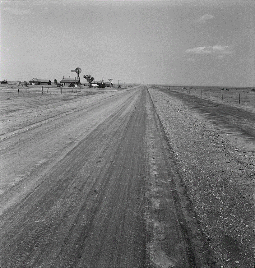
Today, roughly 1 percent of Oklahoma’s population lives in the Panhandle’s three counties, even though it makes up more than 8 percent of the state’s land area. The exact length of the Panhandle, though, is up for debate depending on where you say the region’s eastern edge begins. (Out-of-state travel writers are notorious for putting it too far east.)
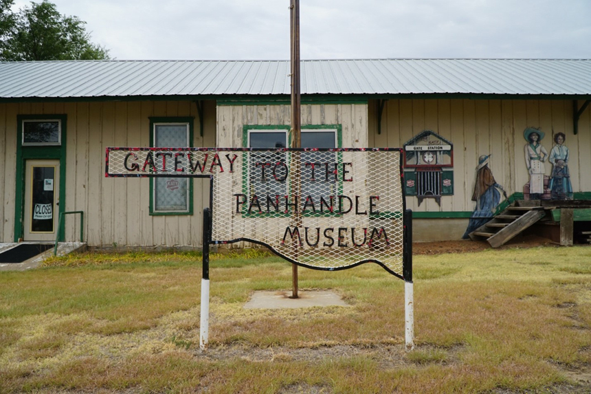
One town makes the Panhandle’s boundaries evidently clear. The eastern entrance to the Oklahoma Panhandle is the aptly named town of Gate. There, the Gateway to the Panhandle Museum — housed in the former Katy Railroad depot — contains artifacts dating back to the Civil War.
The railroad no longer runs through the region; businesses have shriveled up and commerce died out. Faded murals of stagecoaches and settlers paint a picture of a different time.
As I trekked west, classic Outlaw Country hits played over my truck’s speakers — including the Terry Allen song “Amarillo Highway,” famous for the lyrics, “I’m a panhandlin’, manhandlin’, post-holin’, high-rollin’, Dust Bowl-in’ daddy.” Though inspired by the Texas Panhandle, the words are just as fitting for the Oklahoma Panhandle, especially on a long drive down the two-lane highway that follows the lay of the land.
May the Wind Be at Your Back
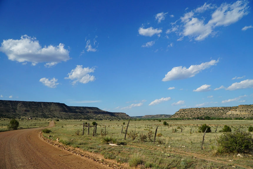
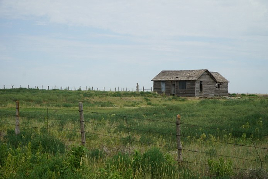
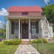
Picture the opening scenes from John Ford’s The Searchers or Ted Post’s Hang ‘Em High, featuring rolling prairies dotted by skyscraping buttes and amber-hued vistas, all under the cover of wide-open skies. These kinds of scenes were rolling through my mind as I drove through the Panhandle along Highway 64, which runs east and west across the northern half of the region. I wasn’t necessarily expecting to see John Wayne or Clint Eastwood loping toward the highway on horseback, but I wouldn’t have been surprised to see it either. Aside from the highway, a few abandoned homesteads, and some rusty barbed-wire fences, the territory remains mostly untouched, a testament to the earth’s natural beauty. It’s landlocked in another period of time.
West of Gate, weary travelers who veer off the highway will find the town of Beaver, the county seat of Beaver County — and the longtime home of the annual World Championship Cow Chip Throw. People from across the nation come together each year to toss dried cow patties into the air, and whoever has the best throw in each division wins. It occurs during Easter weekend each April at the county fairgrounds. The competition started in 1969 out of boredom, and it has become a bit of a media darling. It’s been featured in countless newspaper stories and TV specials, even appearing on ESPN.
Locals say there are some rules, tips, and tricks one has to follow for the best throw. First, the chip must be dry; otherwise, it might stick to your fingers … or leave something behind. Second, the chip needs to be about six inches in diameter. If it’s much larger or smaller, it won’t ride the wind as well. The third pointer is to have proper technique. During this year’s competition, city employee James Pratt told The Oklahoman, “The old secret of throwing is, after you throw your first chip, you’re supposed to lick your fingers before you throw your second chip. It’s supposed to be for luck.” Getting a handle on this may not be for the faint of heart.
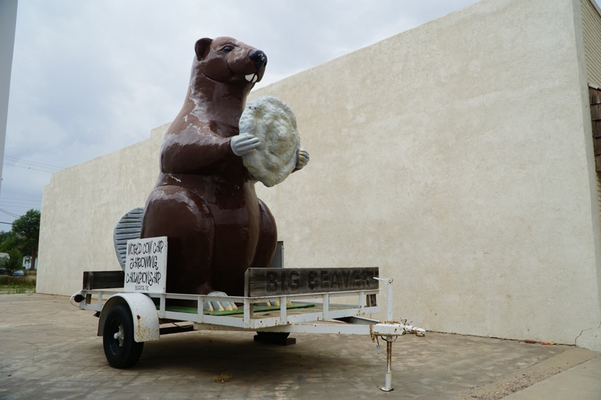
You’d have to plan your Panhandle trip at the right time of the year to participate in the competition. But don’t think the town doesn’t honor its reputation year-round. In a vacant lot on Main Street, a giant, trailer-mounted Beaver statue holds a massive cow-pie beneath its sharp buck teeth. Up and down the street, banners proudly proclaim that the town is the cow-chip capital of the world.
But you don’t have to have a hankering for tossing cow patties to have fun in Beaver. You can ride ATVs at the Beaver sand dunes when you’re not posing for pictures with the statue.
Not What You’re Thinking
After leaving Beaver, I passed through the tiny town of Turpin, hometown of former Dallas Cowboys safety Lynn Scott, and on to a town with an odder claim to fame: Hooker, Oklahoma.
Despite its name, the history of Hooker has nothing to do with the sex trade. It was named after John “Hooker” Threlkeld, a rancher with a gift for roping, or “hooking,” cattle. The town website describes him as “one of the really great ropers of the day” when he moved to the area in the 1870s. Years later, townsfolk were surprised to learn their name had taken on a new meaning. Explanations of how the term earned its meretricious reputation range from a Civil War general who had a band of women to keep his troops entertained to even earlier usages characterizing people who tried to “hook” other people into pyramid schemes.
When the term became widely known, Hooker was immortalized as a town with an ignominious name. And locals have been capitalizing on it for years, giving the town the fitting motto, “It’s a location, not a vocation.” Some took the association further: The high school baseball team’s mascot is the Horny Toad.
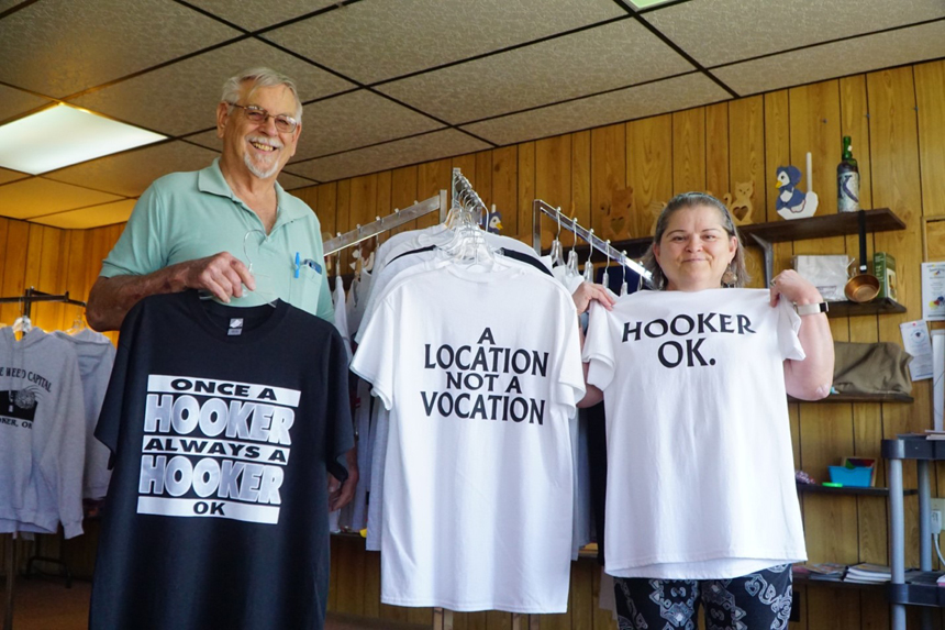
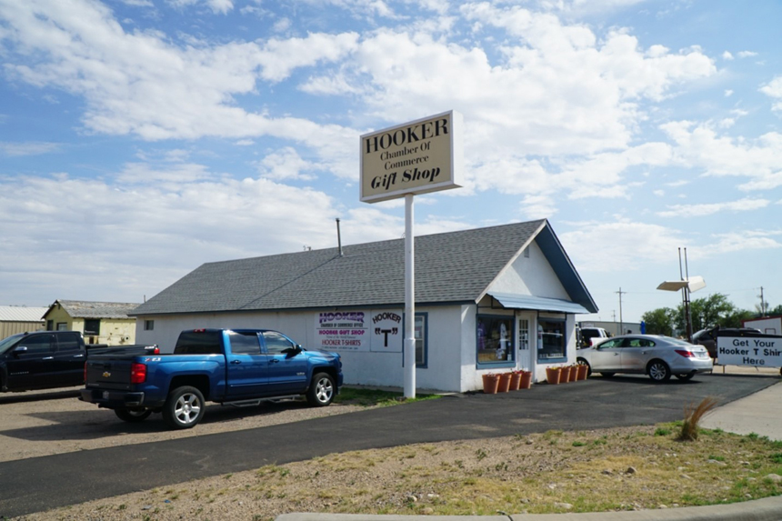
If you’re looking for a good gag gift or a souvenir so you can say, “I’ve been there,” the Hooker Chamber of Commerce maintains a gift shop where you can buy your very own Hooker T-shirt, along with an assortment of coffee mugs, refrigerator magnets, and the like. On a sunny afternoon, Al and Robin Loughridge smiled as they sold merchandise in a small building along the highway. One of the town’s 1,800 residents, Robin has worked at the gift shop for more than 30 years, welcoming passing truckers and tourists from around the world. As far as Hooker jokes are concerned, she’s heard — and told — them all. “When the truckers come in here, and they say, ‘How many Hookers are there?’ I say, ‘1,800,’” Loughridge says. “We have a lot of fun, and they appreciate it.”
Loughridge keeps the gift shop open when she’s not serving as the secretary of the First Christian Church. Her faith in God is central to all she does, even at the Hooker gift shop, she says. A dark brown wooden cross sits high on a shelf above rows of multi-colored T-shirts bearing sayings like “Support Your Local Hookers, OK” and “Once A Hooker, Always A Hooker, OK.” Locals don’t view Hooker jokes as being anything salacious. Even local clergy have fun with it. “They have a sense of humor,” Loughridge says. “They just laugh and roll with it.”
Hooker has more to offer tourists than puns and innuendoes. It’s home to one of the largest car shows in the state each Labor Day weekend, among other celebratory festivals. Folks like the Loughridges hope visitors will stay all night, and stay a little longer, so they can get to know them better.
“Hooker is a friendly town,” Al Loughridge says. “People come in, and we treat them like family.” Robin adds, “We’re not afraid to show our hearts.”
Melting Pot of the Panhandle
Thanks to booming industry, the Panhandle’s largest town — Guymon, about 20 miles southwest of Hooker — has become the cultural melting pot of the Panhandle, according to the Red Carpet Country tourism guide. People from around the globe have moved to Guymon to work in the food processing, manufacturing, and petroleum industries.
Guymon is best known for its vibrant rodeo scene. As the self-billed Saddle Bronc Capital of the World, the town is home to the annual Pioneer Days Rodeo, hosted by the Professional Rodeo Cowboys Association. Hundreds of contestants descend on the town each May, and through the years, the week-long event has churned out some of the country’s most famous rodeo cowboys and cowgirls. After competing in the Pioneer Days, winning participants move on to the National Finals Rodeo in Las Vegas, Nevada.
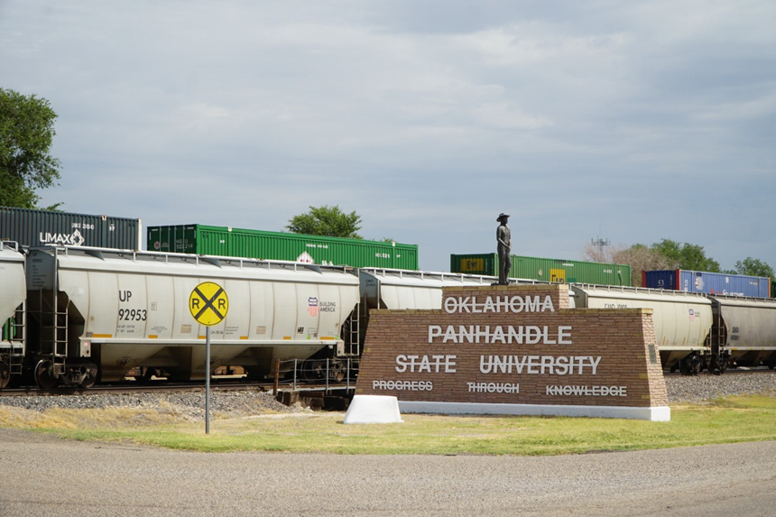
The region’s ties to roping and riding have found their way into the classroom. Oklahoma Panhandle State University in Goodwell, a few miles south of Guymon, has one of the best rodeo programs in the nation, with countless NFR championships and national titles under its students’ belts. “There is no denying that Oklahoma Panhandle State University is the bronc-riding capital of college rodeo,” the university says in a 2014 news release.
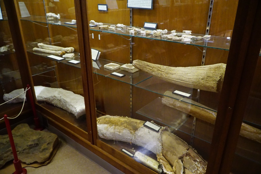
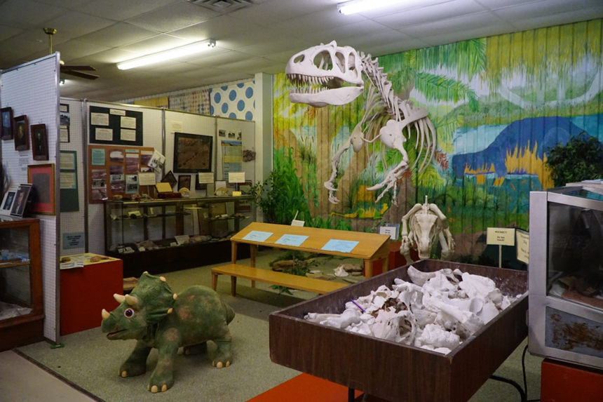
While in Goodwell, I stopped by the No Man’s Land Museum, which displays what is believed to be the first wooden printing press to cross the Mississippi River. Also contained in its collection are countless fossils from dinosaurs and other creatures that roamed the region. Archeological digs are still underway in the Panhandle from time to time, and university researchers continue to unearth prehistoric finds.
I found some historical relics at the museum myself: I was pleasantly surprised to see a VHS tape on sale in the museum gift shop.
I returned to Guymon before continuing the journey. Though the rodeo scene is seasonal, you can shop year-round at several local stores and boutiques lining the brick-paved downtown streets. While you’re there, I recommend grabbing a bite at Mr. Burger, a local fast-food chain where even small orders are large. The whopping cheeseburger will satisfy a hungry traveler until the next stop on the journey: Boise City. And you’d better not confuse the pronunciation with Boise, Idaho. Here, it sounds like “Boys City.”
Still Booming
Boise City is known for a few things. As I found out on my trip, it’s got the only Dairy Queen in the Panhandle. It’s home to a large town museum featuring an outdoor metal dinosaur named “Cimmy,” short for Cimarron. And it is the only U.S. town to be bombed by the U.S. Army Air Corps during World War II.
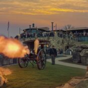
The story goes that a World War II flight crew got off course during a 1943 practice bombing raid, dropping six dummy bombs on the town. No major damage was caused, and no one was injured. In the decades since, the bombing has become the town’s top tourist draw, says Jodie Risley, the director of the Cimarron Heritage Center Museum. One of the original undetonated bombs dropped on the town is on display at the museum. So are countless local artifacts, fully restored farm tractors, a railroad depot, a one-room school house, and a larger-than-life replica of the Tin Man from The Wizard of Oz. It’s a potpourri of local lore that will have you asking questions for hours.
Highest Point
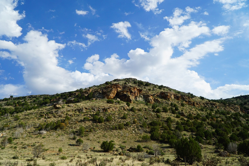
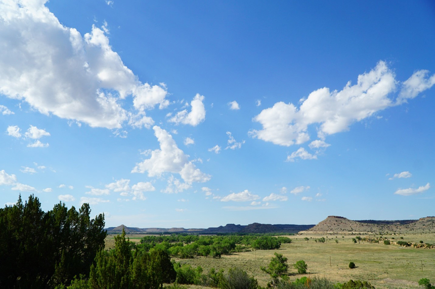
The highlight of any Panhandle trip is watching the sunset as its golden rays cascade over the highest point in Oklahoma: Black Mesa, elevation 4,974 feet. Tucked away in the northwest corner of the Panhandle, Black Mesa is a popular stop for hikers and, seasonally, star-gazers from around the globe. Here, the Milky Way is on full display at night, with no light pollution to muddle the view. From late September to early October, people flock here for the Okie-Tex Star Party featuring “out-of-this-world” guest speakers, a swap meet, food, and other outdoor activities, according to the group’s latest magazine advertisement.
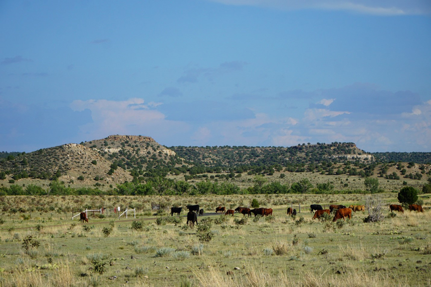
As I drove around the roads winding toward the mesa, I was captivated by the change of scenery. It was nothing like the flatlands I’d been through. Red rock lay along the ground among mesquite trees and sage, creating a vibrant western landscape. The air in the dry, rugged terrain was sweet-smelling and pure. Breathing in the Panhandle’s clean air is easy — until the region’s natural beauty takes your breath away.
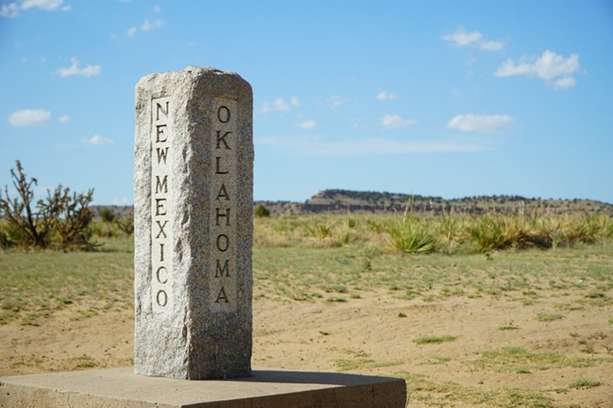
When you’re tired from hiking, you can stay at a nearby working ranch or a bed and breakfast. And at the Preston Monument just a short jaunt from the mesa, you can step into Oklahoma, New Mexico, and Colorado in under a minute.
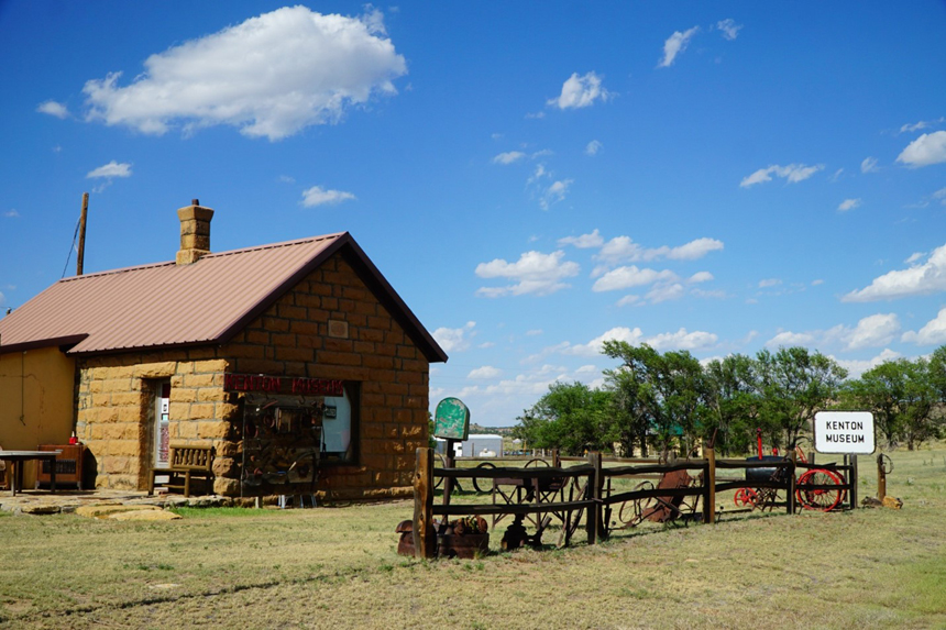
Whenever you go to Black Mesa, check your watch. Oklahoma runs on Central Time, but things run at a slower pace in Kenton, the town nearest Black Mesa — one hour slower, to be exact. The town observes Mountain Time because it is closer to Clayton, New Mexico, and other communities across state lines than it is to any Okie towns. It’s a sleepy community, too, with only a handful of occupied homes, a church, a few abandoned buildings, and a small museum in a wood cabin open by appointment only. The abandoned mercantile building is one of few relics from a more prosperous past. The main road, shaded by trees, provides respite from the hot sun.
Desert Oasis
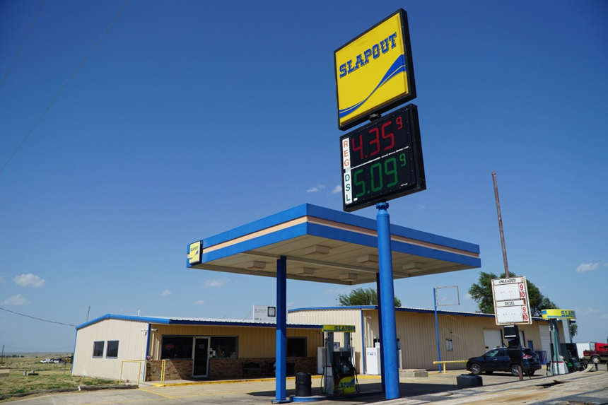
On my way out of the Panhandle, I took a different route. Rather than driving back along Highway 64, I took Highway 412 from Hardesty to Slapout, one of the more colorfully named towns in the Sooner State. It’s known as the longest straight section of highway in the United States. Without a doubt, it was the most desolate drive I’ve ever taken. I saw few other cars on the road, and the temperature soared across the High Plains on that July day. Faded browns and greens enveloped the landscape, and with hardly a homestead in sight, I didn’t just feel like I was in the middle of nowhere. I knew I was.
Slapout got its colorful name because its gas station, the town’s lone business, was historically “slap out” of everything passersby needed. These days, the town is an oasis in its own right – perhaps by default. It’s the last stopping place for miles, and travelers were concerned in 2015 when the store went up for sale. The business was sold, however, and the Slapout legacy carries on. During my stop, station workers were selling Slapout-themed shirts and hats and cooking burgers and fries for hungry customers.
Takeaways
Driving east on Highway 412 might give you the illusion that the Panhandle goes on forever. But once I reached Slapout, I didn’t have long to go before I was back in more familiar parts of the Sooner State. A few hundred miles, a handful of gas station burritos, and a couple tanks of gas later, my trip to the Panhandle was over.
As I reflect on the trip, what I remember most was the view from my front windshield as I looked out across the prairie. The natural beauty of the region still captivates my mind. Sure, the landscape may be desolate, but there’s something about its simplicity that I love. In a world filled with concrete jungles, the ease of navigating the Panhandle is like a balm, soothing over the busy-ness we all too often find ourselves engulfed in.
Of course, the most surprising part of the trip was that this region has plenty of places to see and things to do. Whether it be a museum or a far-flung-dung celebration, the Panhandle’s unique facets are less quirky than you might think. What the Panhandle has to offer aren’t touristy frills, but genuinely interesting landmarks and the stories and people behind them.
My trip through the Panhandle proved some stereotypes wrong. The region is worth visiting, and a trip there is both educational and enjoyable. Of course, there’s one popularly held belief the journey reinforced: the Panhandle is flat. But as I raced eastward on Highway 412, I looked in the rearview mirror at 166 miles’ worth of fun.
After all, I could still see most of it.
Become a Saturday Evening Post member and enjoy unlimited access. Subscribe now
Comments
This was interesting to me simply because I was born in Oklahoma and don’t remember seeing any of it. I was born in Vinita in 1943 and my parents moved back to California when I was 9 mo old. I would enjoy a visit but I’m getting too old!!
Hooker High School’s mascot is the Bulldog. The American Legion Baseball team is the Horny Toads
Looks as boring as it has been. After all, it’s Oklahoma.
This is an unexpectedly delightful, happy surprise of a feature. Kind of like which is America’s oldest theme park, Oklahoma’s panhandle wasn’t something I’d given much thought to before either wonderful online Post features. I have to say you’re an excellent photographer too Jordan, using an actual, real camera!
Glad the Slapout gas station is still working. The the electronic price sign/prices and SUV in the background are the only things non-vintage about it. With those blue skies abounding, it’s hard to know where to start first on a trip into this section of OK. Hooker, I guess. Why not?
.